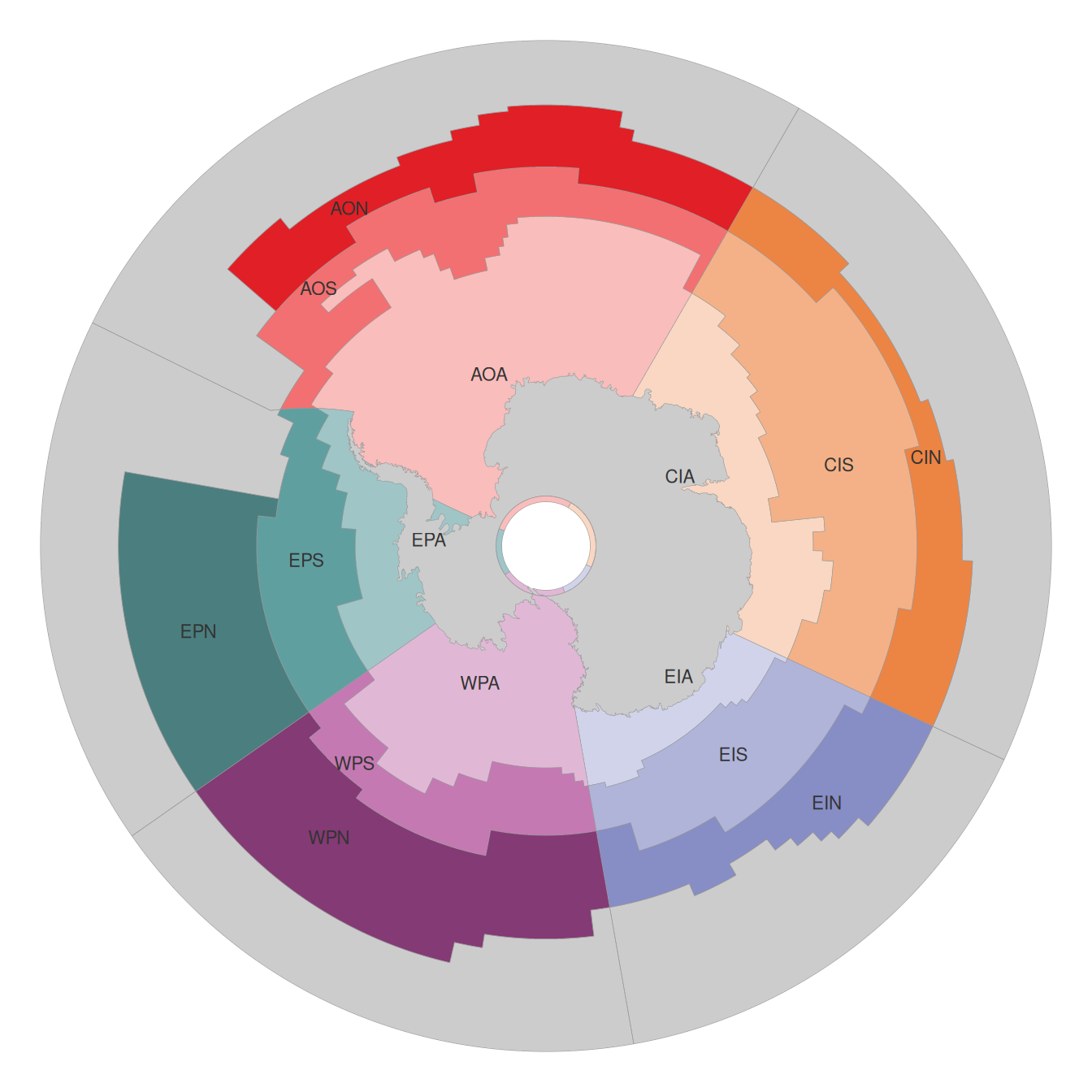
MEASO regions
Southern Ocean regions for the Marine Ecosystem Assessment for the Southern Ocean
The MEASO regions divide the Southern Ocean into five sectors and three zones, giving 15 regions for assessment, summary and comparison. A fourth, northern band in each sector (the “T” regions) covers the remaining ocean to 30°S so that any location in the domain falls in exactly one region.
Get the data
| Format | Polar (equal area) | Longitude/latitude | EPSG:3031 |
|---|---|---|---|
| GeoParquet | measo_regions06.parquet | measo_regions06_ll.parquet | measo_regions06_epsg_3031.parquet |
| FlatGeobuf | measo_regions06.fgb | measo_regions06_ll.fgb | measo_regions06_epsg_3031.fgb |
| GeoJSON | measo_regions06_ll.geojson | ||
| QGIS style | measo_regions06.qml |
Each file has one row per region with columns name, label (e.g. “Antarctic Atlantic”), sector, zone and fill (the region’s colour). See Data for details and stable URLs, and the Use menu for reading the regions in R, Python, DuckDB, the browser and QGIS.
In R, the measoshapes package provides the regions as data sets:
remotes::install_github("AustralianAntarcticDivision/measoshapes")
library(measoshapes)
measo_regions06
How the regions are defined
The regions are built from lines: sector boundaries, three simplified ocean fronts, and the domain edges (85°S to 30°S, all longitudes). Their boundaries are straight lines in longitude/latitude. See Definition.